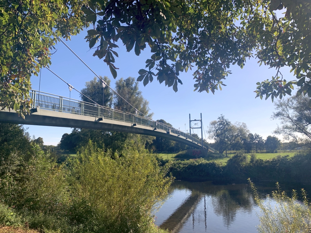
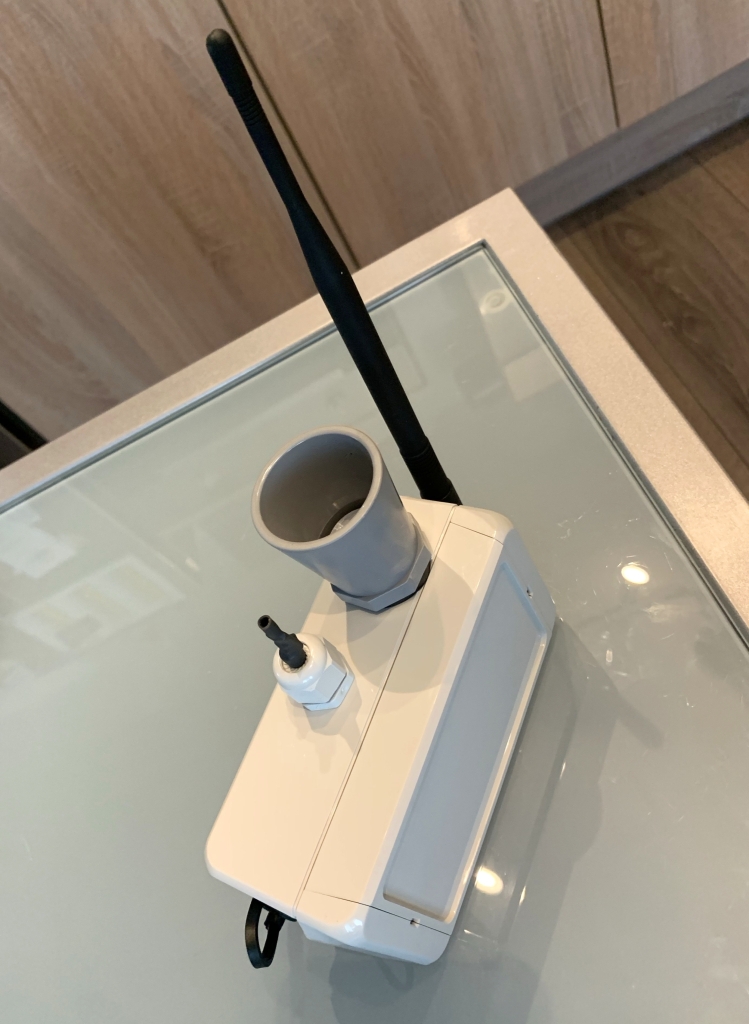
[JN] Seit heute läuft unser neuer Pegelsensor. Dieser wurde durch die Stadt (Danke an das Team der Stadtbetriebe AöR / Fachbereich Wasser – Bau) nun an der Hängebogenbrücke Weingartsgasse über die Sieg montiert und sendet brav alle 15 Minuten einen aktuellen Wasserstand. Bei steigendem Pegel würde der Sensor sogar ab einem bestimmten Anstieg der Sieg in einen 5 Minuten Zyklus wechseln, um noch genauere Daten zu erfassen. Fällt der Pegel, schaltet die Elektronik zurück in den Sparbetrieb und misst wieder alle Viertelstunde.

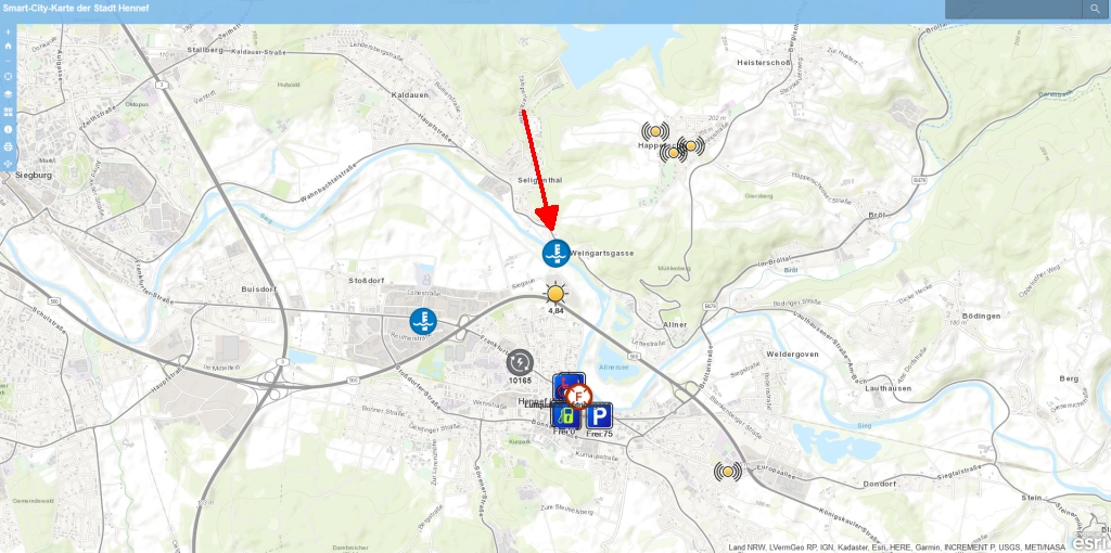
Auch die Stadtverwaltung hat Zugriff auf die Wasserstandsdaten, die per Lora Funktechnik übertragen werden, und so die Möglichkeit, dieses private Projekt zur frühen Information von Feuerwehr und Rettungskräften sowie dem Bevölkerungsschutz einzusetzen. Daher werden die Werte vom Sensor natürlich auch auf der öffentlichen Smartcity-Karte der Stadt Hennef eingetragen und stehen so allen zur Verfügung.

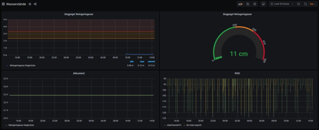
Für Hennef ist die Warnschwelle der Sieg bei einem Wasserstand von 2,5m am Pegel in Betzdorf definiert. Das entspricht c.a. einem Wasserstand von 2,3m am Hilfspegel Hennef. Wenn die Sieg diese Marke erreicht, wird von einer „Hochwasserlage“ gesprochen. Bei steigendem Wasser ab einem Pegel von 4,1m spricht man von einer akuten Gefahr. Die Brücke in Weingartsgasse wird übrigens schon ab einem Wasserstand von 2,6m gesperrt, ab 3,6m wird mit Evakuierungsmaßnahmen in bestimmten Bereichen begonnen. Die Deichkrone der Innenstadt wird ab 4,8m Pegel erreicht …

Aktuell arbeiten wir an 3 weiteren Sensoren, die an den Nebenflüssen der Sieg angebracht werden sollen, um so noch bessere Vorhersagen über die Hochwassergefahr treffen zu können.
Wir freuen uns mit der ehrenamtlichen Arbeit einen kleinen Beitrag zum Bevölkerungsschutz leisten zu können und so das Leben in und um Hennef und den 100 Dörfern sicherer, attraktiver und lebenswerter mit zu gestalten.
Our new level sensor has been running since today. This has now been installed by the city (thanks to the team from Stadtbetriebe AöR / Department of Water and Construction) on the Weingartsgasse suspension bridge over the Sieg and sends a current water level every 15 minutes. If the level rises, the sensor would even switch to a 5-minute cycle from a certain rise in victory in order to record even more precise data. If the level drops, the electronics switch back to economy mode and measure again every quarter of an hour.
The city administration also has access to the water level data, which is transmitted via Lora radio technology, and thus the possibility of using this private project to provide early information to fire and rescue services as well as civil protection. Therefore, the values from the sensor are of course also entered on the public Smartcity map of the city of Hennef and are therefore available to everyone.
For Hennef, the warning threshold is defined as river Sieg at a water level of 2.5 m at the official gauge in Betzdorf. That corresponds to c.a. a water level of 2.3m at the auxiliary gauge in Hennef. If Sieg reaches this mark, it is called a „flood situation“. If the water rises above a level of 4.1 m, one speaks of an acute danger. Incidentally, the bridge in Weingartsgasse is closed from a water level of 2.6m, and evacuation measures are started in certain areas from 3.6m. The top of the dike in the city center is reached from a level of 4.8m …
We are currently working on 3 more sensors that will be installed on the tributaries of river Sieg in order to be able to make even better predictions about the risk of flooding. We are pleased to be able to make a small contribution to civil protection with the voluntary work and thus help to make life in and around Hennef and the 100 villages safer, more attractive and more liveable.

